|
AMORBACH, BAVARIA, GERMANY
|
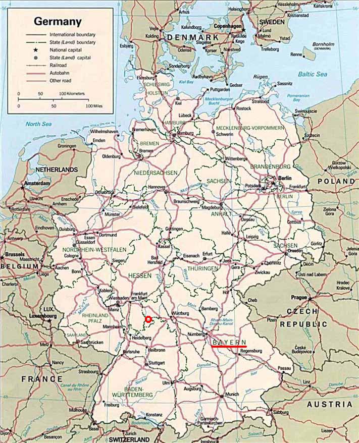 Germany
State Map
Germany
State Map
 Bavaria
Highway Map
Bavaria
Highway Map
 Amorbach
Topographic Map
Amorbach
Topographic Map
 Watterbach
Topographic Map
Watterbach
Topographic Map
|
It was recorded that Lorenz Förtig, Sr. was a tenant of the monastery
farm in Amorbach, Bavaria, Germany
(Bayern,
Deutschland). Three generations of his descendents also lived on the
same monastery farm in Amorbach.
Amorbach is located
approximately four miles
south
of Miltenberg
in
the district of Miltenberg, province of
Unterfranken, in the northwestern
corner of the state of Bavaria.
The town is located in the
Mudau
valley, tributary to the Main River in the beautiful Odenwald Mountains.
The surrounding landscape is primarily forested with coniferous woodlands
on steep mountainous terrain with rolling pastures in the valleys and
on the ridges. Amorbach is located at an approximate elevation of
510 feet. The adjacent
rugged mountains rise up to approximately 1,590 feet for a total height of
1,080 feet above the valley.
The word Amorbach
is translated as "Brook of Love" in the English language1.
Currently, the town is comprised of approximately 4,700 inhabitants1.
In the early eighth century, Count Ruthard directed Saint Pirmin to
travel to what is now the Amorbach area in order to preach the Good News
of the Gospel of the
Lord Jesus Christ2. Saint Pirmin along with his disciple
Saint Amor originally resided
at what is now called
Amorsbrunn, at the northwestern corner of Amorbach. They later
constructed a Benedictine monastery in the neighboring Mudau
valley2. The monastery was consecrated in 734 and became the main
center of civilization and the Christian faith in the Odenwald forest2.
The town of Amorbach expanded around the monastery2. The monks
successfully penetrated into northern Germany and preached the Gospel of grace
unto the
Saxons2.
Amorbach suffered greatly in the tenth century from the
invasion of the Huns and in 1521 during the Peasants' War and also in
1631 from the Swedes2. Many of the original buildings of Amorbach
were damaged or destroyed during the various invasions of the city2. In the seventeenth century, the
monastery buildings and the church were reconstructed2.
The
Benedictine
monastery
located in Amorbach was founded over 1200 years ago1.
In addition, the town of Amorbach has over 800 years of historical documentation1.
The following is a summary of the major historical events of Amorbach:1
Year
Event
734 Establishment of the
Benedictine monastery by Saint Pirmin.1
1170 Establishment of a nun monastery on
the
Gotthardsberg (God
hard mountain).1
1197 First documented mention of Amorbach
under the name Amarbach.1
1253
The monastery is moved from
Konrad von Dürn
to the city.1
1272 Amorbach falls to the rule of the Archbishop of Mainz.1,2
1291
Building of the Templerhauses
(Templer-house).
One of the oldest timber buildings in Germany.1
1448 Building
of the monastery mill, today known as
the Schlossmühle
(lock mill).1
1475 Building
of the
Stadthauses (city
hall).1
1478 Building of the Alten Rathauses (Old town
hall).1
1482-85 Building of the Amtskellerei (Office wine cellar).1
1488 Building of the Zehntscheuer (Tenth-scrub).1
1631-34 Swedes conquer and rule during the 30 Years War.1
1660 Establishment of the Abbey buildings.1
1675
Establishment of the
Mariensäule
(market place).1
1683
Establishment of the Debonhause (Debon building) behind the
Mariensäule.1
1724-27 Building of
the
Oberamtshauses (upper
authority building).1
1742-47 Reconstruction of the
Abtai Kirche (Abbey Church) of Saint Maria.1
1751-53 Building of the St. Gangolf parish church.1
1774-82 Building of the mute organ in the
Abtai Kirche.1
1783-86 Establishment of the Konventbau (convent).1
1803 Protestant Prince of Leiningen seizes control.1,2
1806 Amorbach
falls to the Grand Duchy of
Baden.1
1810 Amorbach
becomes
Hessisch (Hessian).1
1816 Amorbach
becomes
Bayerisch (Bavarian).1
1880
Connection to the Eisenbahnnetz.1
Several
generations of the
Förtig family lived on the monastery farm in Amorbach. Georg
Förtig, the great grandson of Lorenz Förtig, Sr. was born on the
monastery farm and later relocated to the neighboring village of
Watterbach.
Watterbach is located approximately four miles west of Amorbach. The surrounding terrain
is comprised of rolling farm land with mountains forested with a mixture
of coniferous and deciduous trees. Watterbach is located at an
approximate elevation of 850 feet. The adjacent
mountains rise up to approximately 1,715 feet for a total height of 865 feet above the Waldbach valley.
The
descendents of Georg Förtig
attended the Catholic chapel in Watterbach, which
was part of the Catholic parish of Kirchzell.
Watterbach was first mentioned in 1395 in association with the
Amorbach monastery and is a
local municipality of Kirchzell3. It is a small farming village with
currently only 160 inhabitants3. Watterbach is nested into the high rising forested
mountains3. The front of the chapel building is decorated with a plaque of Saint
Sebastian3.
REFERENCES:
1.
History
of Amorbach.
http://www.amorbach.de/
Retrieved information on October 22, 2003
2.
History
of Amorbach.
http://www.amorbach-odw.de/
Retrieved information on February 21, 2004
3.
History
of Watterbach.
http://www.kirchzell.de/
Retrieved information on February 21, 2004
|
|